🗺️ Maps
Discover products tagged with #Maps

Maply.com
Maply is a mapping software that allows users to create interactive and customizable maps for their projects.

Welltory
Welltory is a stress and energy management app that measures your heart rate variability and provides insights to improve your well-being.

VisualGPS
VisualGPS is a software tool for visualizing and analyzing GPS data. It provides a user-friendly interface to track and analyze GPS information.

StepMap
StepMap is a tool for creating custom maps with interactive features. It allows users to add markers, routes, and custom elements to their maps.

SportTracks
SportTracks is a fitness tracking software that helps users analyze their workouts, set goals, and track progress.

SmartCooks
SmartCooks is an AI-powered recipe app that helps users discover and create delicious meals based on their dietary preferences and restrictions.
PhotoLinker
PhotoLinker is a software tool that enables users to easily add GPS location data, IPTC metadata, and keywords to photos. It offers a user-friendly interface and powerful features for organizing and geotagging images.

MapTiler
MapTiler is a mapping platform that allows users to create custom maps, tiles, and 3D geodata for web, mobile, and VR applications.

Komoot
Komoot is a popular route planning and navigation app for hikers, cyclists, and outdoor enthusiasts. It offers detailed mapping, offline navigation, route planning, and tracking features.

Recipe Filter for Chrome
Recipe Filter is a Chrome extension that allows users to filter, search, and sort recipes on popular recipe websites.
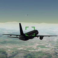
FlightAirMap
FlightAirMap is a real-time flight tracking service that allows users to track flights all around the world.

ChatbotPack.com
ChatbotPack.com is a chatbot building platform that offers a range of tools and features to create AI-powered chatbots for businesses.

Mr. Mo
Mr. Mo is a comprehensive project management tool designed to streamline team collaboration and task management.

Astral Tabletop
Astral Tabletop is a virtual tabletop for role-playing games that offers a variety of tools for game masters and players.
Crying in Public
An emotional release and mental health tracking app that allows users to share their feelings and connect with others going through similar experiences.

Shmeppy
Shmeppy is a simple and fast online virtual tabletop for role-playing games. It focuses on ease of use and quick setup for RPG sessions.

JPlanner
JPlanner is a project management software that helps users organize tasks, set deadlines, and track progress.
MapWithAI
MapWithAI is an AI-powered mapping software that helps users create detailed maps for various purposes.

Product Hunt Map
Product Hunt Map is a tool that visualizes the most popular products on Product Hunt on a map.

Bitesnap
Bitesnap is a food tracking app that helps users track their meals, calories, and nutrition intake.

RideOn Ski Goggles
Smart ski goggles with AR display and real-time data overlay

Humhealth
Humhealth is a comprehensive healthcare software that helps manage patient information, appointments, billing, and more.

TrainAsONE
TrainAsONE is a personalized training platform that uses AI to create custom training plans for runners based on their fitness, goals, and progress.

TomTom Maps APIs
TomTom Maps APIs provide developers with a comprehensive set of mapping and location-based services to integrate into their applications.

PlanarAlly
PlanarAlly is a virtual tabletop tool tailored for real-time online play. It provides a shared whiteboard for visualizing encounters and a variety of features for a smooth gaming experience.
GPSBabel
GPSBabel converts waypoints, tracks, and routes between popular GPS receivers such as Garmin or Magellan and mapping programs like Google Earth or Basecamp.
Flawwwless
Flawwwless is a software tool for automated testing of mobile applications. It offers a user-friendly interface and supports various platforms.
Palaround
Palaround is a social networking platform that focuses on connecting people with similar interests in local communities.

Kitestring
Kitestring is a safety service that checks up on you when you're out and alerts your emergency contacts if you don't respond. It acts as your virtual guardian.

Tripcast
Tripcast is a travel journal app that allows you to share your travel experiences with friends and family in real-time.

Tiled Map Editor
Tiled is a free software package for creating tile-based maps for use in games and other applications.

KML Converter
KML Converter is a software tool that converts KML files to other formats like GPX, CSV, or shapefile.

Savemyluggage
Savemyluggage is a software solution for tracking and managing luggage during travel. It offers real-time updates and alerts to ensure the safety of your belongings.
Crankshaft
Crankshaft is a performance monitoring tool for software applications that helps developers optimize code execution.

FriendsTonight
FriendsTonight is a social event planning app that helps users organize gatherings with friends.

Backdrop
Backdrop is a free and open-source content management system built on top of the Drupal platform. It focuses on ease of use, speed, and flexibility.

AutoCAD Map 3D
AutoCAD Map 3D is a leading GIS and mapping software that provides access to CAD and GIS data to support planning, design, and data management.

RealZips
RealZips is a sales mapping software that helps businesses optimize territories and sales routes.
Map Chart
Map Chart is a tool for creating interactive maps to visualize data geographically.

Geoblink
Geoblink is a location intelligence software that helps businesses to make data-driven decisions by providing insights through location data analysis.

Mapbox Studio
Mapbox Studio is a powerful tool for designing custom maps and visualizing location data.

Strellas
Strellas is a comprehensive project management software that helps teams collaborate and manage tasks effectively.
Footpath
Footpath is a route planning app designed for outdoor enthusiasts like hikers, runners, and cyclists. It allows users to plan, record, and share their outdoor adventures with ease.

Tabletop RPG Map editor 2
Tabletop RPG Map editor 2 is a powerful tool for creating custom maps for role-playing games.

Smashrun
Smashrun is a platform for runners to track, analyze, and share their running data in a visually appealing way.

SAS.Planet
SAS.Planet is a powerful tool for viewing and downloading high-resolution satellite imagery, topographic maps, and other geographic data.

Run on Earth
Run on Earth is a virtual running app that allows users to simulate outdoor runs in various locations around the world.
RoboGEO
RoboGEO is a software program that geocodes digital photos with location data.
PlanePlotter
PlanePlotter is a flight tracking software that allows users to visualize air traffic in real-time on a map. It provides detailed information about flights, aircraft, and airports.

OpenRouteService.org
OpenRouteService is a free online route planner for pedestrians, cyclists, and vehicles offering routing, geocoding, and isochrone analysis. It provides fast and efficient routing algorithms.

MyTripKarma
MyTripKarma is a travel planning and itinerary management platform that helps users create and organize their trips.

myLike
myLike is a social media platform that allows users to share and discover new content based on their interests.

Travlr
Travlr is a travel management software that helps businesses streamline their travel booking and expense management processes.

Polymaps
A JavaScript library for image- and vector-tiled maps using SVG.

eeGeo
A cutting-edge 3D mapping and visualization platform for businesses to create immersive digital twins of real-world locations.

MapMerger
MapMerger is a software tool that allows users to merge multiple maps into a single map with customizable settings.

OnMaps
OnMaps is a powerful mapping software that offers advanced features for location analysis.

ThinkGeo
ThinkGeo is a geospatial software platform that provides mapping and spatial analysis tools for developers.

GPS Track Editor
GPS Track Editor is a software application for Windows and macOS that allows users to edit and analyze GPS tracks.

Mapwize
Mapwize is an indoor mapping platform that helps users to create and manage indoor maps for various use cases.

Wikimapia
Wikimapia is an online editable map that allows users to describe places around the world. It combines the functionality of a wiki and a map.

MapHub
MapHub is a platform for creating interactive maps and adding points of interest with rich multimedia content.

AllTheRooms
AllTheRooms is a comprehensive accommodation search engine that allows users to search and compare listings from various sources including hotels, vacation rentals, and more.

AllTrails
AllTrails is a popular app for finding and exploring hiking trails, with detailed maps, reviews, and photos.

MapKit JS
MapKit JS is a JavaScript library that lets you embed interactive Apple maps on webpages.

App in the Air
App in the Air is a personal travel assistant that helps you organize your flights, track boarding passes, and manage your loyalty programs.

BlurSpy
BlurSpy is a comprehensive parental control and monitoring software for mobile devices.

Pokemon Go Tools
Pokemon Go Tools is a third-party application that provides assistance to Pokemon Go players with features such as IV calculators, maps, and raid guides.

GooPatient
GooPatient is a comprehensive healthcare management software designed for medical practices to streamline their operations.

GpsPrune
GpsPrune is an application for viewing, editing and converting coordinate data from GPS systems.

Hextml
Hextml is a web-based, hex map generator for tabletop RPGs. It allows users to easily create intricate and detailed hex maps for their games.
Guess the Throne
Guess the Throne is a popular mobile game where players have to guess the character sitting on the throne from various fictional worlds.

MapBusinessOnline.com
MapBusinessOnline is a web-based business mapping software that helps businesses visualize and analyze their data on maps.

Mayo Clinic
Mayo Clinic is a nonprofit American academic medical center focused on integrated clinical practice, education, and research. It employs over 4,500 physicians and scientists, along with another 58,400 administrative and allied health staff.
MyTrails
MyTrails is a popular hiking and outdoor activity tracking app that allows users to plan, track, and share their outdoor adventures.

Outdooractive
Outdooractive is a popular platform for outdoor enthusiasts offering route planning, GPS tracking, and outdoor guides for various activities like hiking, biking, and skiing.

QLandkarte GT
QLandkarte GT is the ultimate outdoor aficionado's tool for GPS maps in GeoTiff format as well as Garmin's img vector map format.

Gaia GPS
Gaia GPS is a popular outdoor navigation app for hiking, hunting, offroad, and other outdoor activities. It offers topographic and satellite maps for offline use, route planning, tracking, and various tools for outdoor enthusiasts.

Rthm
Rthm is a comprehensive health and wellness app that focuses on personalizing your fitness and nutrition routines.

Wonders
Wonders is a comprehensive software solution for project management and collaboration.

Wikiroutes
Wikiroutes is a platform that provides information on public transportation routes and schedules.

Close Enough Clock
A fun and quirky clock that tells time with a slightly inaccurate twist, adding a touch of humor to your space.

DIABASS
DIABASS is a comprehensive diabetes management software that helps users track blood glucose levels, insulin intake, medication, and other vital health data.

Facebook Places
Facebook Places was a feature that allowed users to share their current location with friends. It was integrated into the main Facebook app.

Instant Heart Rate
Instant Heart Rate is a popular app that measures your heart rate using just your phone's camera. It provides accurate results and various features to monitor heart health.

PokeFind.com
PokeFind.com is a website that helps Pokemon Go players find and catch Pokemon in their area.

GPX Editor
GPX Editor is a software tool for editing GPX files used in GPS devices for activities like hiking, biking, and geocaching.

Houdahgeo
HoudahGeo is a geotagging software for Mac that allows you to add location information to your photos. It offers features like easy geocoding, reverse geocoding, and supports various metadata formats.

RadarBox
RadarBox is a flight tracking software that provides real-time aircraft tracking information.
RememberItNow
RememberItNow is a medication management software that helps users keep track of their medications, appointments, and overall health.

TomTom GO Mobile
TomTom GO Mobile is a GPS navigation app with real-time traffic information, offline maps, and speed camera alerts.

Dinevore
Dinevore is a restaurant recommendation software that helps users discover new dining experiences based on their preferences.

HERE
HERE offers location services and mapping solutions with real-time traffic information, geocoding, and routing functionalities.

fabtrackr
Fabtrackr is a project management software that helps teams track and manage tasks efficiently.

GPSies
GPSies is a platform for outdoor activities where users can plan routes, track activities, and share experiences.

Baidu Map API
Baidu Map API is a powerful mapping platform provided by Baidu, offering various mapping services and location-based solutions.

Tango Strategic Store Lifecycle Management
Tango Strategic Store Lifecycle Management is a comprehensive solution for managing all aspects of store lifecycle, from planning to execution.

Tactician One
Tactician One is a project management software that helps teams organize tasks, track progress, and collaborate effectively.

AmCharts Javascript Maps
AmCharts JavaScript Maps is a powerful and flexible tool for creating interactive maps using JavaScript. It offers a wide range of customization options and supports various map projections.

Eolas Medical
Eolas Medical is a software product that offers advanced medical record management and patient scheduling solutions for healthcare providers.