🗺️ Maps & Navigation
Discover products tagged with #Maps & Navigation

Azure Maps
Azure Maps is a set of location APIs providing geospatial context to data. It provides mapping, search, routing, traffic, and time zone services.

Badger Maps
Badger Maps is a route planning software that enables field sales reps to visualize their sales territories and optimize their routes.

AUTOsist
AUTOsist is a vehicle management software that helps users track vehicle maintenance, fuel, and other important records.

Moovit
Moovit is a public transportation app that provides real-time information on public transit routes, schedules, and service alerts.

Maverick
Maverick is a powerful project management software that helps teams collaborate and stay organized.
uDig
uDig is an open-source desktop GIS software that allows users to view, edit, and analyze geospatial data.

PostGIS
PostGIS is a spatial database extender for PostgreSQL that adds support for geographic objects allowing location queries to be run in SQL.

GRASS GIS
GRASS GIS is a free and open source Geographic Information System (GIS) software suite used for geospatial data management and analysis, image processing, graphics/maps production, spatial modeling, and visualization.

SAGA GIS
SAGA GIS (System for Automated Geoscientific Analyses) is a free and open-source geographic information system used for editing and analyzing spatial data.

Sky Map
Sky Map is an astronomy app that allows users to explore and identify celestial objects in the night sky.

SkyView
SkyView is a cloud-based project management software with advanced collaboration features.
MapLarge
MapLarge is a powerful mapping software that enables users to visualize and analyze large datasets on interactive maps.

My Car
My Car is a cutting-edge automotive software that helps users manage their vehicle maintenance schedules, track expenses, and analyze performance data.

EasyMapMaker
Easy-to-use mapping tool for creating custom maps with markers, lines, shapes, and more.

Nexar
Nexar is a smart dashcam app that connects drivers to the road. It uses AI technology to provide real-time alerts, collision reconstruction, and more for safer driving.

Fuelly
Fuelly is a popular app that helps you track your vehicle's fuel consumption and mileage.
Uber Transit
Uber Transit allows users to plan and pay for public transportation rides within the Uber app.
Mileage
Mileage is a mileage tracking software for businesses and individuals to accurately track their mileage for tax deduction purposes.

OpenTable
OpenTable is an online restaurant reservation service that helps users discover restaurants and make reservations.

MapWindow GIS
MapWindow GIS is an open-source geographic information system software for spatial data analysis and visualization.

PeakVisor
PeakVisor is an app that helps outdoor enthusiasts identify mountains in real-time using the smartphone's camera and augmented reality technology.

Snazzy Maps
Snazzy Maps is a repository of different styles for Google Maps aimed at web designers and developers.
Fuelio
Fuelio is a comprehensive fuel tracking app that helps users monitor fuel consumption, costs, and efficiency for vehicles.

GEEKtyper
GEEKtyper is a fun website that simulates typing like a hacker in movies. It provides a range of themes and backgrounds to make it look authentic.

gvSIG
gvSIG is a Geographic Information System (GIS) software designed for capturing, storing, handling, analyzing, and deploying all types of referenced geographic information. It is open-source and offers a wide range of functionalities.

MeteoEarth
MeteoEarth offers interactive weather maps with high-resolution meteorological data. Users can explore weather patterns worldwide in a visually appealing way.

Gas Manager
Gas Manager is a software tool designed to help users manage their gas consumption and expenses effectively.

Stamen Maps
Stamen Maps offers beautiful, customizable map styles for web and print use.

PetrolSpy
PetrolSpy is a software that helps users find the cheapest fuel prices in their area.

FlightAware
FlightAware is a popular flight tracking service that provides real-time flight status and tracking information.
Garmin BaseCamp
Garmin BaseCamp is a software to plan outdoor activities, organize data, and share your adventures.

RadarBox
RadarBox is a flight tracking software that provides real-time aircraft tracking information.

GPSies
GPSies is a platform for outdoor activities where users can plan routes, track activities, and share experiences.
GPSBabel
GPSBabel converts waypoints, tracks, and routes between popular GPS receivers such as Garmin or Magellan and mapping programs like Google Earth or Basecamp.
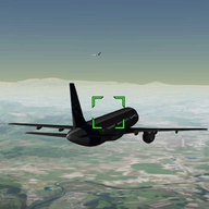
FlightAirMap
FlightAirMap is a real-time flight tracking service that allows users to track flights all around the world.

GeekPrank.com
GeekPrank is a website that offers various online pranks and practical jokes to play on your friends and colleagues.

Azimap GIS
Azimap GIS is a cloud-based geographic information system that allows users to create, edit, and share interactive maps and spatial data.

ProAlign
ProAlign is a software solution for aligning project management with business strategy.

Mapon
Mapon is a comprehensive GPS tracking and fleet management software that helps businesses monitor their vehicles and assets in real-time.

TransSys Solutions FZC
TransSys Solutions FZC is a software company that specializes in providing digital transformation solutions for businesses.
Pocket Universe
Pocket Universe is a mobile app that allows users to explore and learn about the universe through an interactive and educational experience. Users can view stars, planets, constellations, and other celestial objects in real-time.

SkySafari
SkySafari is a powerful planetarium that fits in your pocket, puts the universe at your fingertips, and is incredibly easy to use!

Voyages-SNCF
Voyages-SNCF is a popular online platform for booking train tickets in France.

Inspirage
Inspirage is a global consulting firm that helps organizations enhance their supply chain and logistics operations.

OpenJUMP GIS
OpenJUMP is an open-source Geographic Information System (GIS) written in Java. It is a desktop GIS application that supports a variety of geospatial data formats and functionalities.

GeaCron
GeaCron is an interactive world history atlas that covers over 3000 years of history from antiquity to modern times.

mobi. Locate
mobi. Locate is a mobile device management software that helps businesses track and manage their devices in real-time.

FlyView
FlyView is a virtual tour software that allows users to create interactive 360-degree virtual tours for real estate, tourism, and other industries.

Star Walk
Star Walk is an interactive astronomy guide that shows celestial objects in the real-time sky map.

Ãffi
Öffi is a public transport app that provides real-time information about public transportation schedules and routes.

Geomoto
Geomoto is a powerful geolocation software for tracking vehicles and assets in real-time.

OpenGTS
OpenGTS is an open-source GPS tracking software that offers fleet management and tracking capabilities.
Funliday
Funliday is a travel planning software that helps users organize their trips, create itineraries, and discover new destinations.

GasBuddy
EzLabor

DB Navigator

Telematics GPS

Topo Maps+
Road Trip MPG

AAA Gas Prices

Fuel Buddy
ViewRanger

Car Report

AutoBoy Dash Cam
Plane Finder
OpenSky Network
ADSB Hub

LeadPlotter

TouchTrails

Probus
Journey Planner

DHL eShop

MyRoutes Route Planner Pro

Track My Trip

QuestTag Delivery

MyRoute Multi Stop Navigation

Logistia Route Planner

Plan my Trip: Route Planner

MultiAddress

iMyFone AnyTo Location Changer

CARFAX Car Care

Geoapify Places API

Here Places API

Google Places API

Star Roam

Star Finder Free

Starlight
Whitebox GAT

GeoDa

ORTOVOX ALPINE TOURING APP
Diva GIS

Star Walk 2 Free

Galaxy Map

Alminav

Visitor Map

Plotaroute

Mobile Number Location
Mobile Number Locator
Find Location-Phone Number Tracker
